
3.5star
192 reviews
10K+
Downloads

Everyone
info


About this app
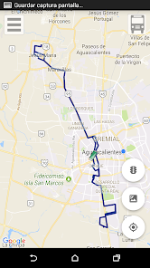
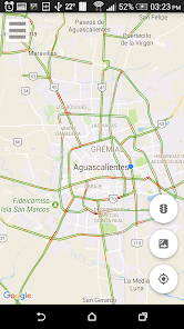
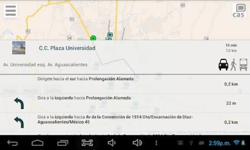
With this app you will see on a map Routes Urban Transport of the State of Aguascalientes, as well as Point of Interest, Agencies and Entities, Service Centers and Services (CAS), industrial parks, clinics and hospitals.
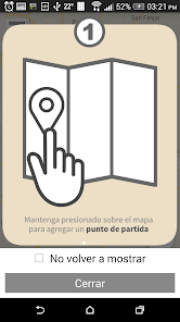
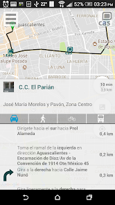
Selecting a point, you can choose the route by car, on foot or routes may be obtained near the site. Also you can select the photo on the left for the street view of the place is displayed.
When selecting a category a "button" appears at the top of the map, select a list of points that particular category will display, also can do a custom search.
Updated on
Data safety
Developers can show information here about how their app collects and uses your data. Learn more about data safety

No information available
Ratings and reviews
3.5
192 reviews

A Google user
- Flag inappropriate
June 26, 2019
la app esta muy bien, seria fantastico que lo de las rutas se pudiera utilizar sin datos
2 people found this review helpful
Gobierno del Estado de Aguascalientes
January 7, 2020
Gracias por tu comentario. La primera vez que inicias la app se descargan los datos y quedan guardados en la memoria del teléfono. Sólo tendrías que entrar a la app y navegar un poco para que parte del mapa también se guarde en la memoria temporal, de esta manera ya puedes usarla (parcialmente) sin necesidad de datos.
A Google user
- Flag inappropriate
August 8, 2019
pesima !
Gobierno del Estado de Aguascalientes
January 7, 2020
Gracias por tu comentario. Nos gustaría que nos comentaras si la información no se mostró correctamente o cuales son los aspectos donde podemos mejorar la app.
What's new
Corrección de error al mostrar la ruta del Punto A al Punto B


